
Durban, South Africa
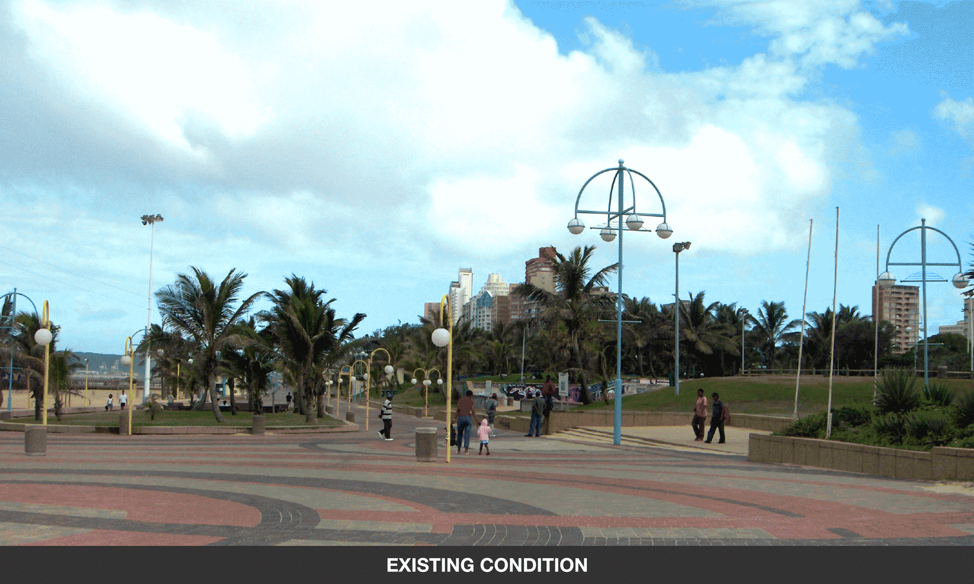
Durban Beachfront Upgrade
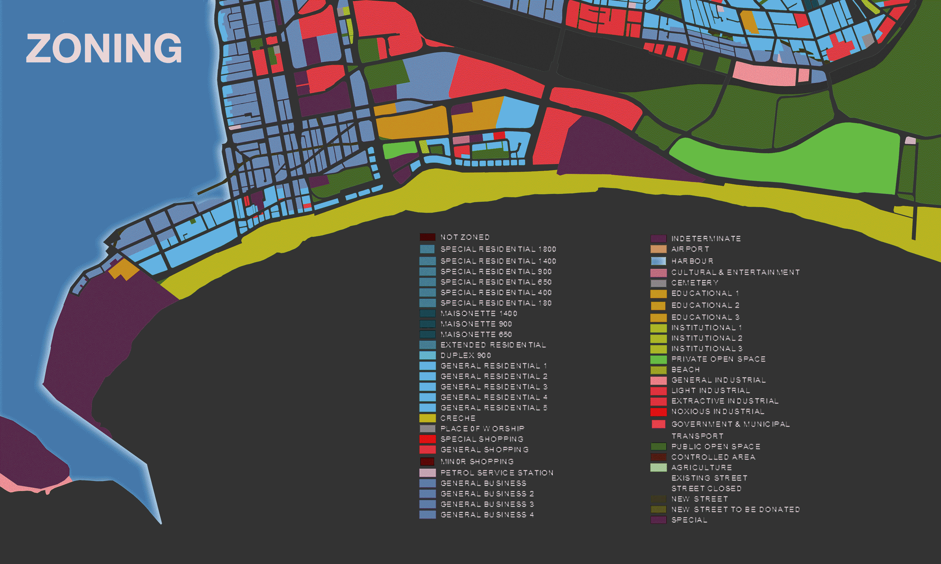
Part of the Durban Beachfront upgrade project included the commissioning of soundspacedesign by the Ethekwini City Architects to investigate the site in the broadest terms – from street furniture, to amenities, landscaping, lighting, topographical audits, research on user groups and potential bulk calculations in light of further amenity and hospitality needs for the FIFA World Cup of 2010 and beyond.
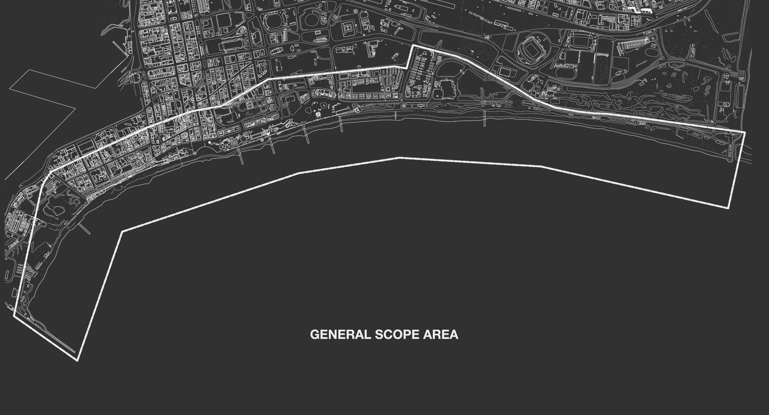
Stretching from the harbour mouth in the south, to the Umgeni River mouth in the North, the beachfront is Durban's most valuable public domain and includes a wide variety of potentially buildable sites between the back-of-beach urban grid and the upper limits of the tidal zone.
Durban Beachfront Urban Design Precincts
A special survey of various cross-sections through the eighteen-kilometre stretch of beach was undertaken in order to clarify the existence of buildings and also to verify the position of the high-tide waterline with respect to walkways, walls and the general detritus of a century’s worth of beachfront history.
In this exercise, it became apparent that a vast tract of land is potentially developable below the Upper Marine Parade, but still within the build-to-line, subject to a City pronouncement on climate change induced inundation which at the time was subject to conflicting official opinions.

This potential developable land-tract as a resource that the City should safeguard for future generations was illuminated in the study.
Seasonal primary display
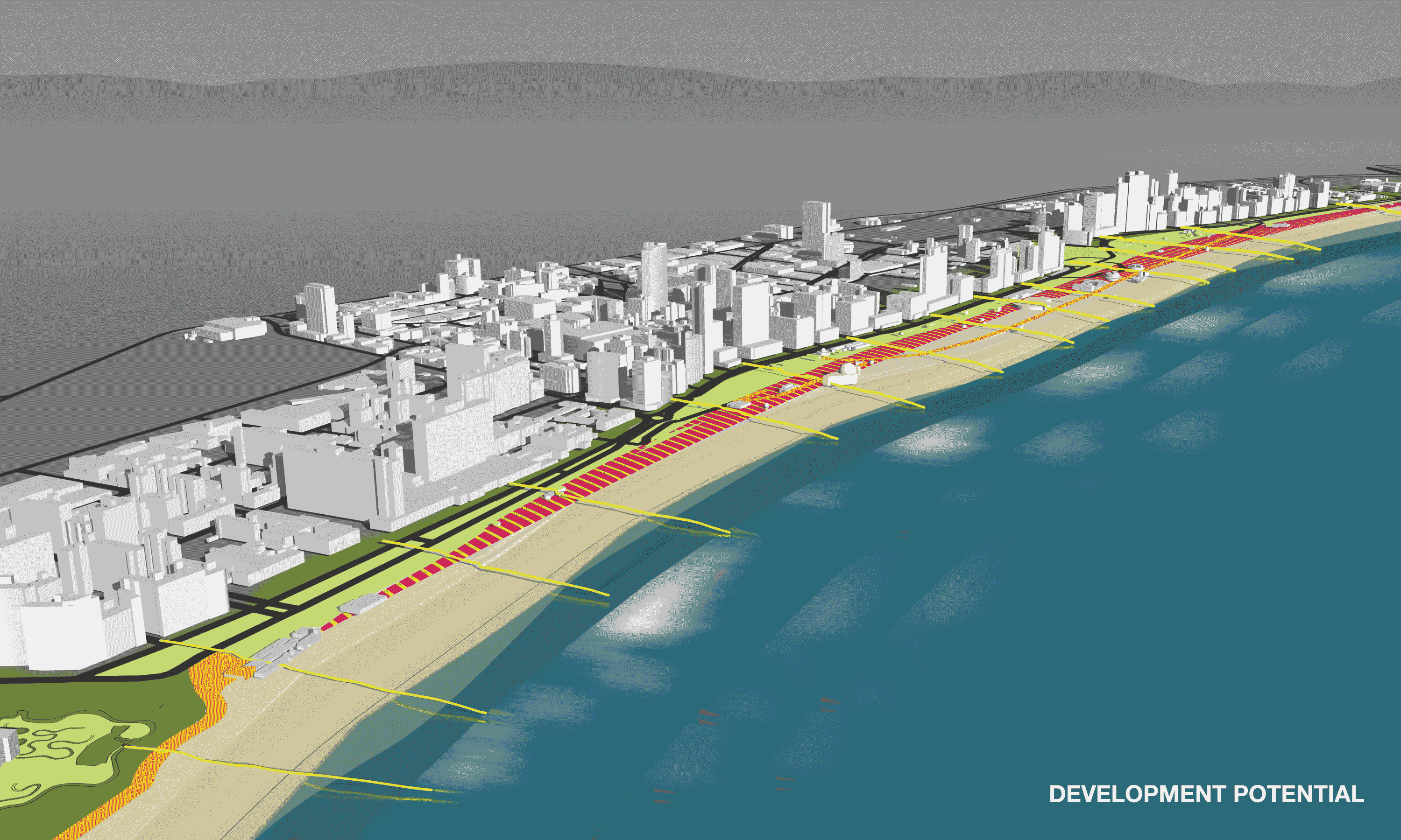
Towards the end of the appointment a number of development nodes were identified that became the subject of further design conceptualisation and implementation by a range of local architects as credited in the diagrams below.
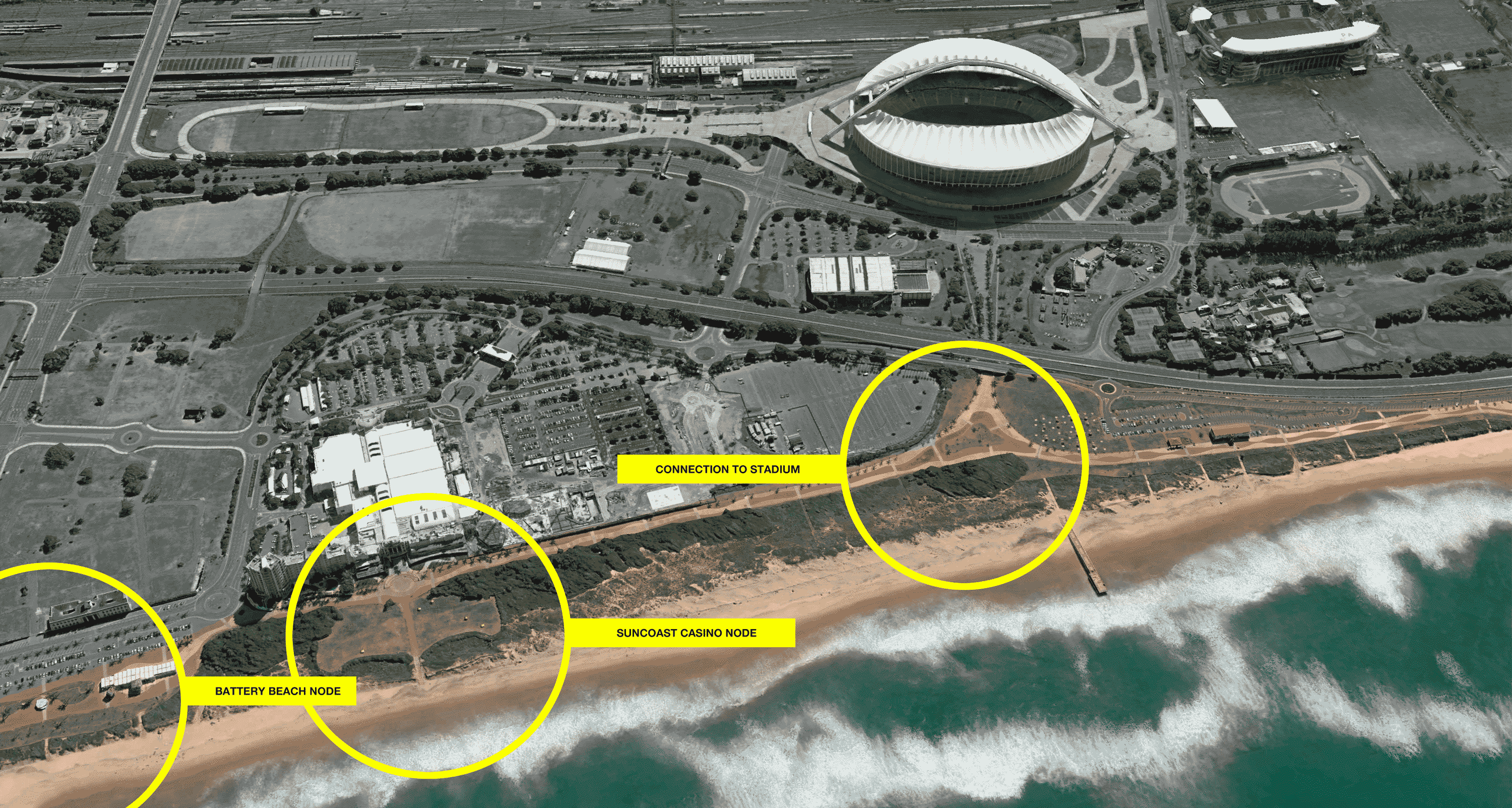
Each node provides public amenity and relates to its hinterland in a localised fashion, with the final piece in the puzzle at Vetch's Pier coming to completion recently, while the public and tourists await the erection of a string of new hotels at the Point.
similar projects


